
Active Systems
None
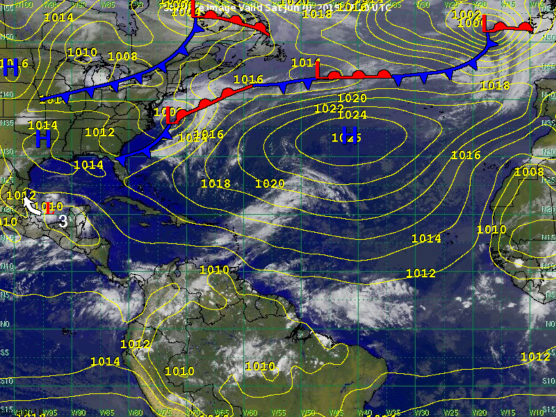
Other Disturbances / Areas to Watch
Disturbance 3 is currently a broad area of low pressure located near 20N, 94W in the Bay of Campeche. It is moving towards the west-northwest near 6 kts (7 mph). The system is forecast to track very slowly across the Bay of Campeche this weekend bringing heavy showers and thunderstorms. The west-northwest motion is expected to become more northwesterly by early next week. Our latest data indicates that the center of the system will move ashore on Tuesday near Tampico as a tropical depression or tropical storm.
Atmospheric and oceanic conditions are expected to be favorable for development. We have once again increased our chance of development to 60 percent. Our first advisory will be issued shortly.
Regardless of development, our primary concern is heavy rainfall and flooding. This is especially true over eastern Mexico near the Gulf of Mexico. Areas of heavy showers and thunderstorms are likely to impact the states of Veracruz and Tamaulipas through the first half of the upcoming week. Moisture from the system will likely extend northward into Texas as well. Periods of heavy showers and thunderstorms are forecast to impact southern and coastal Texas during the Tuesday through Thursday time frame.
Significant impacts to the northern Gulf of Mexico are not expected due to strong wind shear over the region. If the system does track farther north than forecast, it will likely be a weaker system due to unfavorable environmental conditions.
Meteorologist: Justin Petrutsas / Nick Kosar