
Active Systems
None
Other Disturbances / Areas to Watch
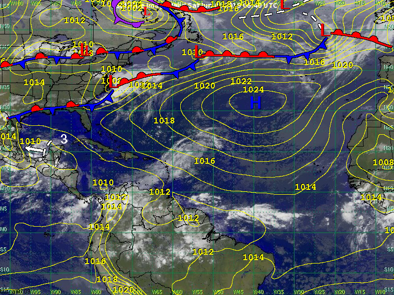
Disturbance 3 has been identified along 91W in the Bay of Campeche. It is moving west near 6 kts (7 mph). The system will track very slowly across the Bay of Campeche this weekend bringing heavy and gusty showers and thunderstorms. Its westward motion is expected to become more west-northwest by Sunday or Monday. Our latest data indicate that the center of the system will move ashore by Monday or Tuesday in the vicinity of northern Veracruz or southern Tamaulipas.
Atmospheric and oceanic conditions are expected to be at least somewhat favorable for development. However, the system’s close proximity to land could limit the development potential. That being said, we do think development chances have increased since the previous update. Therefore, we have increased the chance of development from 10 percent to 30 percent.
Regardless of development, our primary concern is heavy rainfall and flooding . This is especially true over eastern Mexico near the Gulf of Mexico. Areas of heavy showers and thunderstorms are likely to impact the states of Veracruz and Tamaulipas through much of the upcoming week. We will also need to monitor how far north the moisture from the system will extend. As early as Tuesday, moisture from the system could enhance thunderstorm activity over southern Texas despite the center of the system being near Tampico. The best chance of showers and thunderstorms from this system impacting southern and coastal Texas will be during the second half of the upcoming week.
Significant impacts to the northern Gulf of Mexico are not expected.
Meteorologist: Cameron Self