
Active Systems
| Name | Max Wind | Classification | Lat | Lon |
|---|---|---|---|---|
| 3 | 30 mph | Tropical Disturbance | 19.4N | 95.1W |
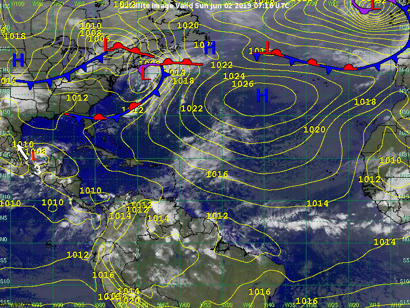
3
Disturbance 3 is a broad area of low pressure in the Bay of Campeche about 260 miles southeast of Tampico, Mexico. It is moving to the west-northwest at 4 mph. There is a 60 percent chance that the disturbance could develop into a tropical depression or weak tropical storm before making landfall over eastern Mexico Monday afternoon or evening to the south of Tampico. Regardless of development, the greatest threat to Mexico is flooding from heavy rainfall. After moving into eastern Mexico, rapid weakening is expected. Some of the rainfall from the remnants of the system could move into Texas later in the week. The system could produce heavy squalls with wind gusts up to 50 mph and locally rough seas across the Bay of Campeche and the southwestern Gulf of Mexico through Tuesday or Wednesday of this week.
Please see our latest advisory on your StormGeo web portal for more information.
Other Disturbances / Areas to Watch
There are no other disturbances across the North Atlantic tropical basin.
Meteorologists: Claude Aultman / George Harvey