
Active Systems
None
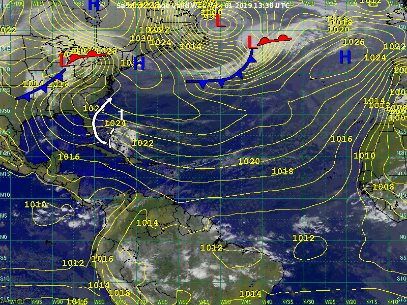
Other Disturbances / Areas to Watch
Disturbance 1 has formed over the western Bahamas. It is a surface trough. Most of the showers and storms are located to the east of the surface trough. Thus, no tropical development is likely within the next couple of days. However, system is expected to bring heavy rainfall to the Bahamas today and tomorrow. Locally heavy rains, likely in the 1 to 3 inch range, are likely for eastern parts of the Florida Peninsula tomorrow and Friday.
After Friday, the system is expected to turn to the northeast, passing south of the coast of South and North Carolina. At this time, there is a slight chance that tropical or subtropical development will occur. The chance of development within the next 7 days is currently 10 percent. Regardless as to whether or not tropical development were to occur, we do not expect a significant impact to the Carolina coast. This is because the heaviest rains and strong winds should remain south of any potential center.
Meteorologists: Derek Ortt / Chris Hebert